
Contact Us
Tel. No: +44 20 8744 2884
Email: hello@thevelvetprinciple.co.uk
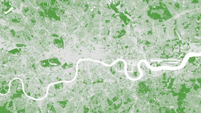
Image Courtesy: Greater London Authority (2020)
A few months ago, I set off from home and went for a 25km circular walk. Mostly along paths and trails flanked by grass, waterways and trees. So, what’s so remarkable about that I hear you say? Well, I don’t live in the Yorkshire Moors, Cotswolds, Snowdonia or an equally bucolic part of the UK – I live in West London. I might have had to cross 4 or 5 roads -including the not so insignificant A3. But other than 1.5k or so along residential roads close to home, I was able to go for a 25k ‘country walk’ in one of the most congested cities in the world. A walk that took in a park, common, small woodland and river tow path. Personally, I think that’s pretty amazing.
West London has more than its fair share of open green spaces. But as well as being one of the most congested cities in the world, London, as a whole, is also one of the greenest. No doubt there are other parts of The Capital that are equally blessed, while others are not so fortunate. Just look out the airplane window on a daylight flight into Heathrow and you can’t help but notice pockets of green stretching out across the city.
There have and continue to be many initiatives designed to promote the greening of our towns and cities, as well as encourage more active lifestyles and enjoyment of the natural environment. Not least, among the cohort of national trails, the 298km Thames Path, that starts at the source of the Thames in Gloucestershire and follows the river through to Woolwich. Contained within the city ‘borders’ are the 126km Capital Ring and the 240k Outer London Loop . Trails, that circumnavigate the capital – passing through a series of parks, commons and nature reserves en route.

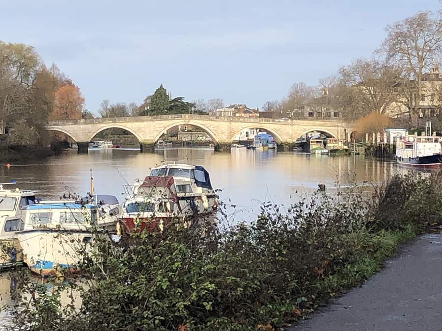
Walking green trails and open spaces along tow paths and parks in West London
The ambition to establish a connected network of green infrastructure – The All London Green Grid – was captured in the Supplementary Planning Guidance to the All London Plan 2011. Within this, as well as creating new parks and open spaces, there is an emphasis on establishing green linkages between these assets across the capital.
There is something compelling about the opportunity to walk through a major world city, via a network of parks, nature reserves and green corridors, rather than pavements on busy roads. The wayfinding community has the potential to play an important role in implementing these ambitions. By capturing and increasing the visibility of this green infrastructure within the navigation information we design. By virtue of it being home, the focus has been on London, but these sentiments apply equally to cities and towns across the UK and beyond!
When creating the wayfinding strategy for a large development, wayfinding consultants will routinely examine adjacent public transport routes, roads and cycle paths. They will also no doubt, include references to natural landscape features located close by. But do they always make explicit the availability of green routes on the doorstep? I’m not so sure. But it is certainly an aspect we need to be factoring into the mix.
Tel. No: +44 20 8744 2884
Email: hello@thevelvetprinciple.co.uk